Welcome to Him River Power Limited !

PROJECT DETAIL
Liping Khola Hydropower Project (LKHP) is in Tatopani Village Development Committee (VDC) of Sindhupalchowk district in Bagmati Zone of Central Nepal. As per the Generation License, the location of the project is
| Latitude | 27˚58’11” N to | 27˚59’15” N |
| Longitude | 85˚56’30” E to | 85˚57’44” E |
The project’s headworks are situated at an altitude of 2,555m above mean sea level, precisely at latitude 27°59’09″N and longitude 85°56’36 “E, approximately 3 km upstream of the point where Liping Khola and Bhotekoshi meet. The majority of project structures are proposed to be located on the left bank of Liping Khola. Similarly, the powerhouse of the project will be situated at an elevation of 1,735masl, at 27°58’20″N and 85°57’21″E. The project will generate 16.26 MW of power using two units of horizontal axis turbines coupled with generators by utilizing 2.45 m3 /s discharge, falling through a height of almost 800 m. The 132kV transmission line will be used to evacuate the power.
Project site, nearby powerhouse area, can be accessed via Araniko National highway and is located at about 115 km from Kathmandu (Figure 1.3). There is no motorable road access available within the project area; one must walk along the recently built foot tracks to reach to project component sites. An access road connecting the nearest road head in Araniko highway is currently under construction and the construction materials from powerhouse to headworks and along the penstock is planned to be transported using both Swiss-ropeway and Indian-ropeway.
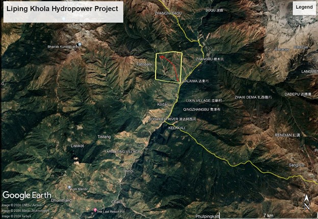
Close-up view of the project area can be seen in the Figure 1.1. Location of project can be seen in the map presented in Figure 1.2.
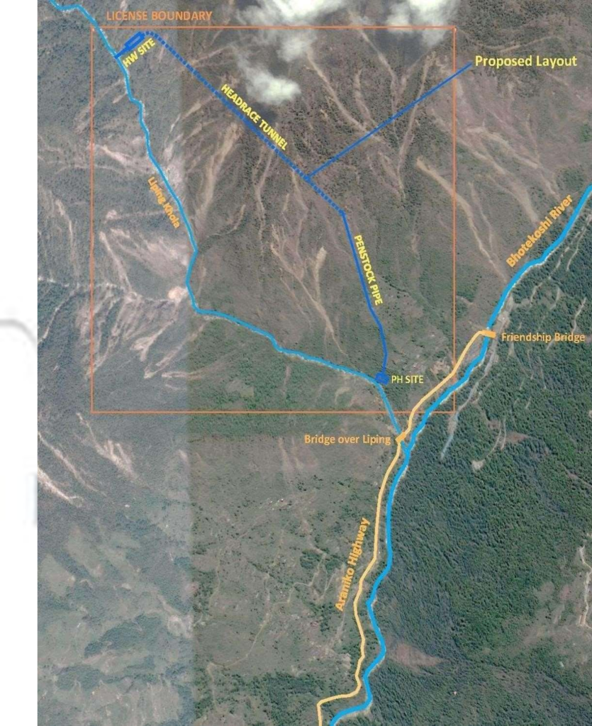
Figure 1.1: Close-up View of Project Area in Google Image
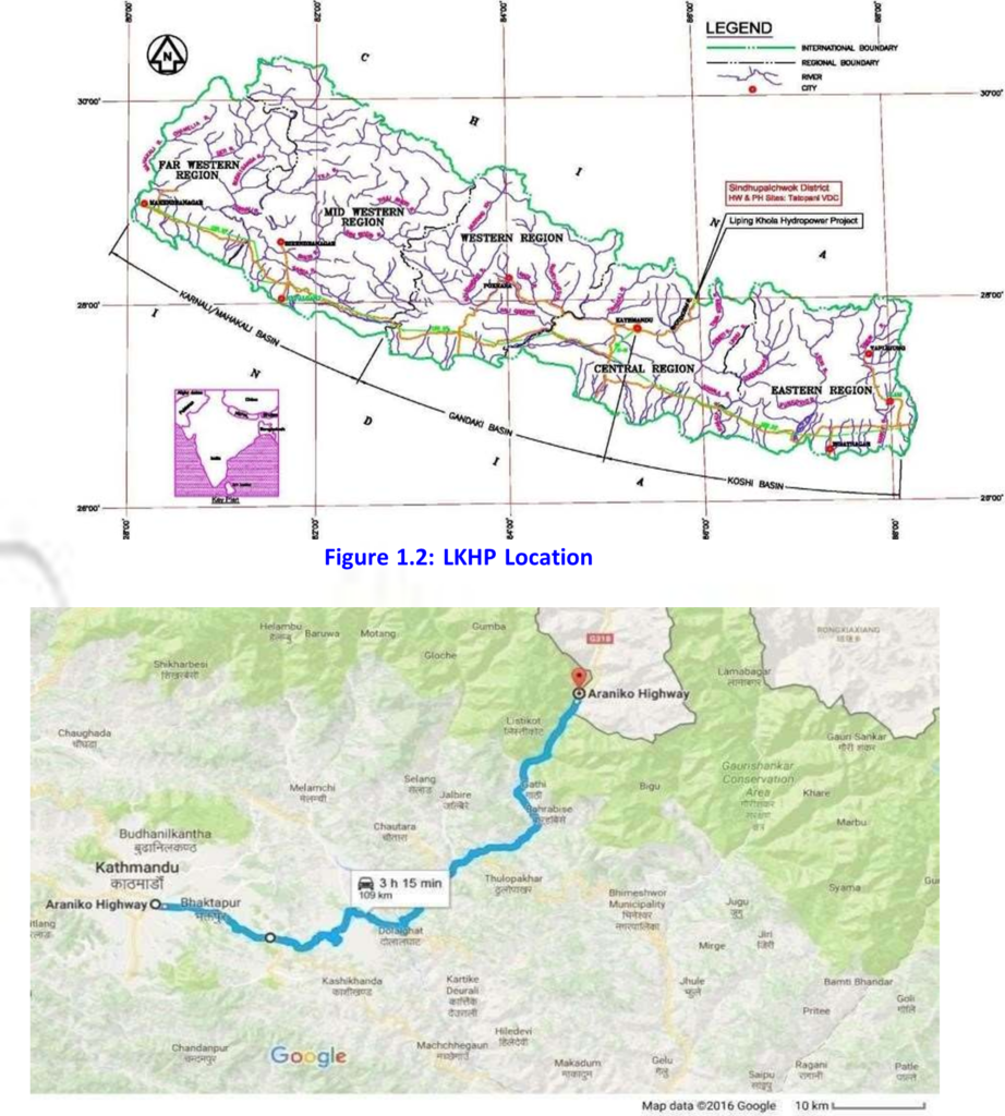
Figure 1.3: Project Area Accessibility of Project
| From | To | Distance (KM) |
| Dolalghat | 53 | |
| Dolalghat | Bahrabise | 30 |
| Bahrabise | Chakhu | 13 |
| Chakhu | Liping Khola Bridge | 15 |
| Total | 111 | |